File:Watkins Map.jpg
Jump to navigation
Jump to search
No higher resolution available.
Watkins_Map.jpg (800 × 582 pixels, file size: 106 KB, MIME type: image/jpeg)
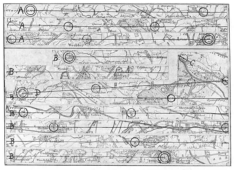
Description: Alfred Watkins' map of ley lines.
Date: 1922
Source: Early British Trackways, Moats, Mounds, Camps and Sites
Author: Alfred Watkins (1855–1935)
File history
Click on a date/time to view the file as it appeared at that time.
| Date/Time | Thumbnail | Dimensions | User | Comment | |
|---|---|---|---|---|---|
| current | 00:29, 11 November 2024 | | 800 × 582 (106 KB) | Occultwiki (talk | contribs) |
You cannot overwrite this file.
File usage
The following page uses this file: